Patapsco Valley State Park
| Location | Directions |
|---|---|
| McKeldin Area, Shelter 576 Google Map | From I-695/I-70 West take I-70 to Marriottsville Rd. (Exit 83). Go North on Marriottsville Rd. for 4 miles to the park entrance on the right. After paying park entrance fees, follow O-signs to shelter #576.
From I-70 East take Rt. 40 (Exit 82, Balt. Natl. Pike) to Marriottsville Rd. Turn left. Park entrance is 5 miles on the right. After paying park entrance fees, follow O-signs to shelter #576. |
| McKeldin Area, Shelter 501 Google Map | From I-695/I-70 West take I-70 to Marriottsville Rd. (Exit 83). Go North on Marriottsville Rd. for 4 miles to the park entrance on the right. After paying park entrance fees, follow O-signs to shelter #501.
From I-70 East take Rt. 40 (Exit 82, Balt. Natl. Pike) to Marriottsville Rd. Turn left. Park entrance is 5 miles on the right. After paying park entrance fees, follow O-signs to shelter #501. |
| Glen Artney Google Map | Find the large parking area where the northwest end of I-195 meets South Rolling Road just west of I-95 and you'll be there. To put it another way, head to BWI Airport on I-95, but instead of taking the I-195 connector east to the airport, head the opposite way (west) and in less than 1 mile from I-95 you'll be at the correct parking area. Google Maps Link Apple/iPhone Link |
| Granite Area Google Map | Park in the large parking lot to the south of St. Alphonsus Rodriguez Church on Old Court Rd. From the Marriottsville Rd exit of I-70, go north on Marriottsville just 0.8 miles and then turn right on Old Frederick Rd (Rt 99). Go east 0.8 miles, then turn left (north) on Woodstock Rd. In 2 miles the church will be on your left, after Woodstock Rd has changed its name to Old Court Rd. |
| Rockburn Branch Park Google Map | To our pavilion on the park's west side: From I-95, take Route 100 west (Exit 43B). Go about a mile on Route 100, and take the exit onto MD 103 west. Turn right at the first traffic light onto Montgomery Road. Turn left at the next traffic light to stay on Montgomery Road. After about a half-mile, turn left into the park at Rockburn Elementary School. Follow the park entrance road for 3/4 mile, then turn left up the hill to the pavilion at the end of the road. |
| CCBC Catonsville Google Map | Take 95 to 195/166 west. Take this until the road ends at South Rolling Road (keep right or you will end up in the Park-n-Ride). Go right/North on South Rolling Road. South Rolling Road has speed cameras so pay attention to the posted speed limit. Take South Rolling road to Campus Drive (there is a stop light there). Go left on Campus Drive. Follow Campus Drive to the top of the hill where the road splits to make a loop around the campus; keep left at this split. Follow the road around to Lot 6. Registration will be towards the field. |
| Avalon area Google Map | From I-195 exit 3 in Elkridge MD, take US 1 South. Then take the first right, and very soon afterwards the first left into Patapsco State Park. Follow road to park entrance, pay the weekend park entrance fee ($2/vehicle in-state, $4/vehicle out-of-state), and then go left at the T intersection. The Avalon parking/registration area is just after the road curves to the right after crossing the river (near the large playground), and will be in one of the two pavilions. |
Upcoming Events at this Venue
There are currently no events scheduled at this venue in the next six months. Please check back later or consider hosting an event at this venue with full club support.
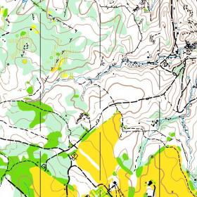
Sample Orienteering Map